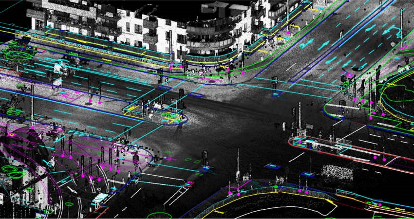
We bring innovation to the forefront of surveying with our state-of-the-art Mobile LiDAR Survey (MLS) services. Revolutionizing the data collection landscape, Mobile LiDAR Survey involves mounting LiDAR sensors on mobile platforms, providing highly accurate and detailed 3D point cloud data for various applications. Explore the efficiency, speed, and precision that define our MLS services.

Transportation Asset Management: Supporting transportation agencies, our Mobile LiDAR Survey ensures accurate 3D data for asset management, road maintenance, and infrastructure planning. From pavement analysis to bridge clearance assessments, we deliver actionable insights.
Urban Planning and Development: In urban planning, our surveys create detailed 3D models of cityscapes, building footprints, and streetscapes. [SSanvi] supports land use planning, zoning analysis, and visualization for proposed development projects.
Utility Infrastructure Mapping: Mapping utility infrastructure such as power lines, pipelines, and telecommunications networks, our MLS services assist utilities companies in asset management, vegetation encroachment analysis, and emergency response planning.
Environmental Monitoring and Resource Management: Employed for environmental monitoring, our surveys provide detailed topographic data for floodplain mapping, coastal erosion studies, vegetation analysis, and habitat mapping. Contribute to sustainable resource management with accurate insights.
Emergency Response and Disaster Management: In disaster management, [SSanvi]'s Mobile LiDAR Surveys support rapid damage assessment, evacuation planning, and infrastructure restoration. Our services play a crucial role in post-disaster recovery efforts.